SHORT TRACK | 40 km | 850 elevation meters
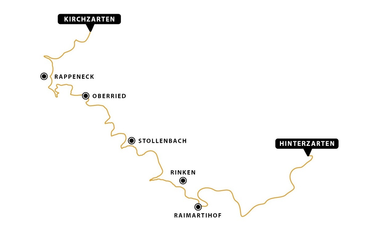
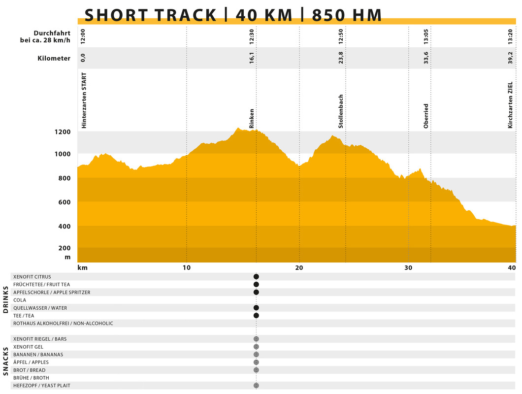
The SHORT Track, with 40 km and 850 meters of elevation gain, is our fun route for everyone. Because, in total, it goes more downhill than uphill! After the starting shot at the train station, you first climb steeply up and out of Hinterzarten, over Bruderhalde on many beautiful, diverse paths to Raimartihof. At Raimartihof, the route diverges from ULTRA, Marathon, and Short Track.
After the challenging ascent to Rinken, you've not quite reached the halfway point of the race. Here, at the refreshment point, you can replenish your reserves. After a short break, you descend towards Zastlertal and from there to Berggasthaus Stollenbacher Hütte. Circling around Ruheberg, you head downwards and then onto the Hans-Joschy-Trail.
Continuing on Panoramaweg, you turn right onto a trail down to Oberried. Now you're almost there, because from now on you don't really have to climb any more and you get directly to the finish line in the stadium.
Shuttle from Kirchzarten to Hinterzarten
For all Short Track riders, we have a special offer:
You can travel to the starting point in Hinterzarten by train from Kirchzarten. We will collect the bikes at the train station and securely load them onto our special transporters. Once you have handed over your bike, you can relax on the train so that you arrive in Hinterzarten together with your bike right in time for the starting shot. 😊
You can travel to the starting point in Hinterzarten by train from Kirchzarten. We will collect the bikes at the train station and securely load them onto our special transporters. Once you have handed over your bike, you can relax on the train so that you arrive in Hinterzarten together with your bike right in time for the starting shot. 😊
Elevation profile
Hot spots
# Raimartihof
# Rinken
# Oberried Obertal
# Rinken
# Oberried Obertal
Refreshment points
| Verpflegungsstelle | UTM-Koordinaten (WGS84) | Dezimalgrad (WGS84) |
| Rinken | 32T 427032 5303956 | 47.884788°, 8.023983° |


